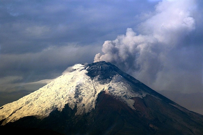
Behind the Ecuadorian city of Latacunga towers a majestic active stratovolcano of almost 6.000 m height – the Cotopaxi. Bearing a white snow cap all through the year, the handsome mountain resembles its smaller Japanese twin, Mount Fuji, which it surmounts by not less then 2 km.
As much as the Cotopaxi is a beauty, it is a threat too. Named by the locals “Taita” (Father), he is indeed a terrible ruler of the entire region, one that demonstrated more than once that he can easily extinguish land and people.
The last major eruption in 1877 led to a spring flow of lahar – a tsunami of melted snow and ashes – that avalanched down the mountain with a speed of 80 km / h and poured into the plains as deep as 100 km. The city of Latacunga got buried in no time under a thick cover of mud. Today, as a reminder of the catastrophe, one can see the top of a church bell tower sticking out only 3-4 meters from newly formed ground. However, not many constructions withstood the attack of the lahar flow at all. They were simply washed away.
In the past years, the volcano has become conspicuously active again. Since the 1800´s some 50 eruptions have been counted. According the volcanologist, a major eruption is overdue since decades. While a minor eruption is estimated to take a toll of about 20.000 victims, a large one threatens with about 200.000 expected casualties. An apocalyptic number.
To provide scientific help and insight for territorial analysis and disaster management, the Institut Superior Universidad Cotopaxi (ISUC) had been established as a centre for applied research and education. ISUC, in a cooperation established via the German Assocation of International Cooperation (GIZ), has collaborated since 2019 with HafenCity University´s chair of Digital City Science. The joint goal is the adaptation of HCU´s digital Toolkit for Open and Sustainable City Planning and Analysis (TOSCA) for the very task of local evacuation planning and disaster mitigation.
Impulsed by TOSCA, ISUC established a new Laboratory for the Analysis of the Territory (LAT) to be built around the toolkit as the central facility of investigation. TOSCA forming the technological anchor of the new laboratory, other digital tools e.g. Virtual Reality or advanced simulation engines, may complete the Lab´s profile in the future, too.
While scientific research remains the key focus of the TOSCA-based lab, human capacity building, training and dissemination activities form a second eminent track. ISUC and GIZ ambitiously aim to upscale the application of the toolkit not only to further schools and institutions in the Cotopaxi region, but across entire the Latin Americas in the next years.
The training session and scientific conference at ISUC in August-September this year took a decisive step in this direction. The teams of ISUC, GIZ and HCU decided together with local stakeholders and representatives of the regional government how TOSCA could support volcanic risk management on the ground. In view of the expected next eruption of the Cotopaxi, easy and quick yet comprehensive geospatial data analysis becomes a power tool to outline safe evacuation routes, to model future lahar flows in the area, or to provide emergency help without delay.
With such capacities at hand, “Father Cotopaxi” may induce less fear in the future. It may change into a natural phenomenon [wonder] whose violent forces can be faced and dealt with, whose beauty can be marveled at without deep-sitting unrest.
by Prof. Dr.-Ing. Jörg Rainer Noennig
No responses yet